Know your assets.
Sense the change.
FloodSense helps local authority flood teams keep a living register of their flood assets and monitor each one's condition from orbit, so you see an asset silting up or a bund breached before a site visit. Every figure is a real measurement you can defend. A prioritised worklist. A complete audit trail.
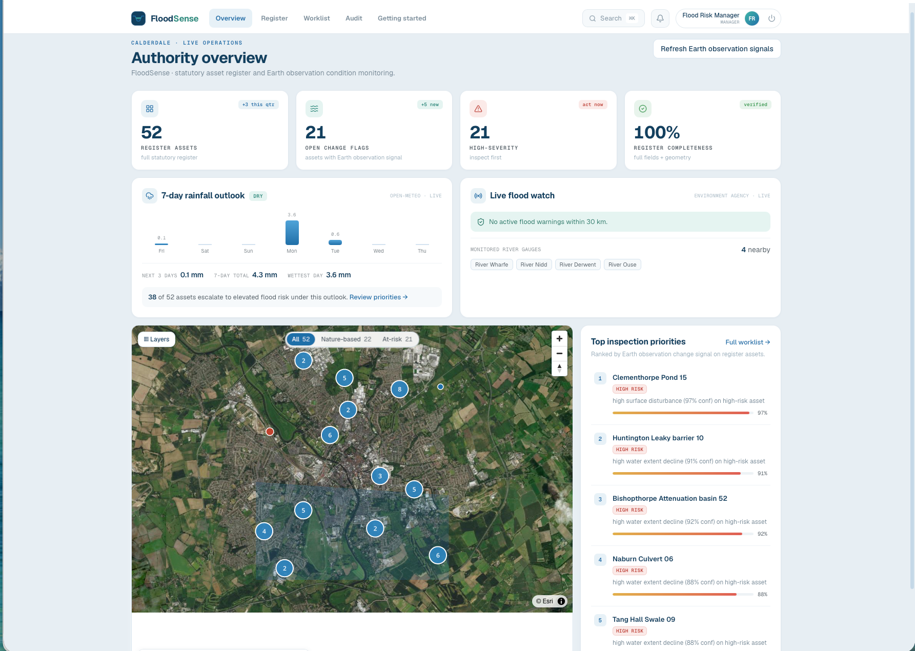
A statutory duty that spreadsheets handle badly, and assets you cannot see change.
Every Lead Local Flood Authority in England has a statutory duty under the Flood and Water Management Act 2010 to keep a register of significant flood-risk assets, the Section 21 register. In practice these registers live in spreadsheets and go stale, while hundreds of small, dispersed assets, ponds, culverts, leaky barriers, wetlands, silt up or get damaged unseen between site visits. Teams cannot inspect everything every year, and there is no easy way to see change across the whole authority from the desk.
Sources: Environment Agency, National assessment of flood and coastal erosion risk in England, 2024; Department for Environment, Food and Rural Affairs flood defence investment programme, 2024 to 2026.
From register to inspection, in one place.
Build the register
Import your assets from GeoJSON, KML or a shapefile, with designation, owner, risk and location, filterable and exportable.
Monitor from orbit
Sentinel-2 satellite imagery tracks water extent and surface change over each asset footprint, cloud-masked, refreshed as new passes arrive.
Measure, do not guess
Larger assets report a measured area in square metres with a stated uncertainty; the smallest are clearly labelled indicative, never a false precise figure.
Prioritise inspection
A worklist ranked by change signal, modelled risk and how long since the last inspection, with a seven-day rainfall outlook on top.
Inspect, record, audit
Field surveys from any phone browser, a complete audit trail, least-privilege roles, and reports exported to Excel, PDF or GeoJSON.
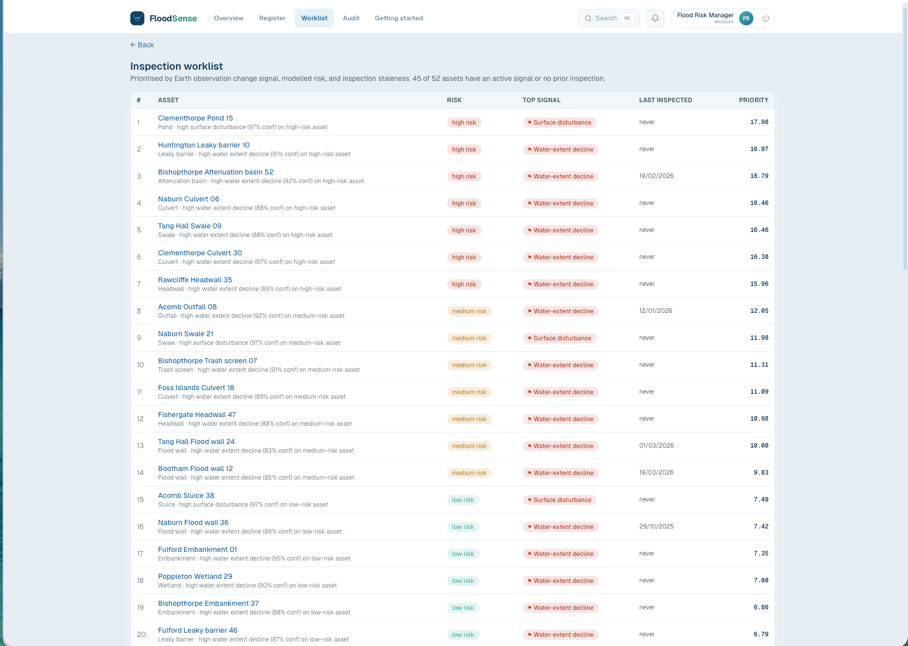
The prioritised inspection worklist. Ranked by change signal, modelled risk and inspection staleness.
Built for the flood-asset problem, not generic asset management.
Living statutory register
A current Section 21 register with import, filter and export, not a stale spreadsheet.
Satellite condition monitoring
Built on Sentinel-2 from the European Copernicus programme, free and openly licensed, so monitoring the whole authority carries no per-image cost.
Defensible measurements
Open-water and bare-ground area in square metres with a stated uncertainty, and an honest indicative label where the asset is below satellite resolution.
Change detection and worklist
Automatic flags for water-extent decline, surface disturbance and vegetation loss, feeding a prioritised inspection worklist.
Rainfall forward-risk
A seven-day rainfall outlook combined with each asset's risk band to show which assets face elevated potential flood risk.
Audit, roles and exports
Every decision and action recorded, role-based access, and council-ready reports in Excel, PDF and GeoJSON.
See the whole catchment at a glance.
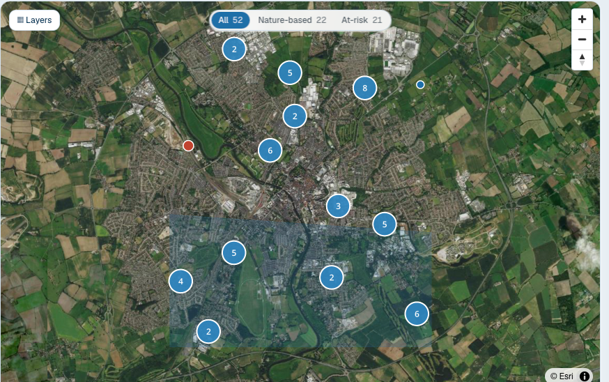
An interactive map, with live Sentinel-2 satellite imagery as an option, clusters every asset across the authority, coloured by change signal or by rainfall risk. Zoom in to expand clusters, open any asset, and switch what the colour shows in a click.
What good looks like.
Inspect what matters
Effort goes where satellite data shows real change, not on a blanket cycle.
Defensible to members
Measured areas in square metres with uncertainty, and a stated method, that stand up to scrutiny.
Earlier warning
See deterioration between site visits, before it becomes a flood.
Time back
Less spreadsheet wrangling for officers, one current record for the team.
Public-sector data protection and accessibility, built in.
UK data residency
Application and database run in the United Kingdom.
Tenant isolation and row-level security
Each authority's data is isolated at the database level.
Complete, append-only audit trail
Every decision and action recorded, and never quietly overwritten.
Web Content Accessibility Guidelines 2.2 level AA
Built to the standard, with a published accessibility statement.
Cyber Essentials certified
Certified against the government-backed security baseline.
Data-protection-impact-assessment ready
Satellite imagery carries no personal data; demonstrations use clearly labelled demonstration data.
Start with a pilot.
Annual software licence per authority, scaled by the number of assets, with satellite monitoring included. Begin with a paid pilot on your own register. Not a self-serve checkout; this is a conversation.
Know your assets. Sense the change.
Book a demo and see FloodSense on a real catchment.
Book a demo or start a pilot
Tell us about your authority and we will be in touch. A demo walks you through the live product; a pilot puts FloodSense to work on your own assets.